
File:Woleai old map.png

本预览个尺寸:800×562像素。 其他分辨率:320×225像素 | 640×450像素 | 1,024×719像素 | 1,200×843像素。
原始文件 (1,200×843像素,文件大小:22 KB,MIME类型:image/png)
小结
| 描述 |
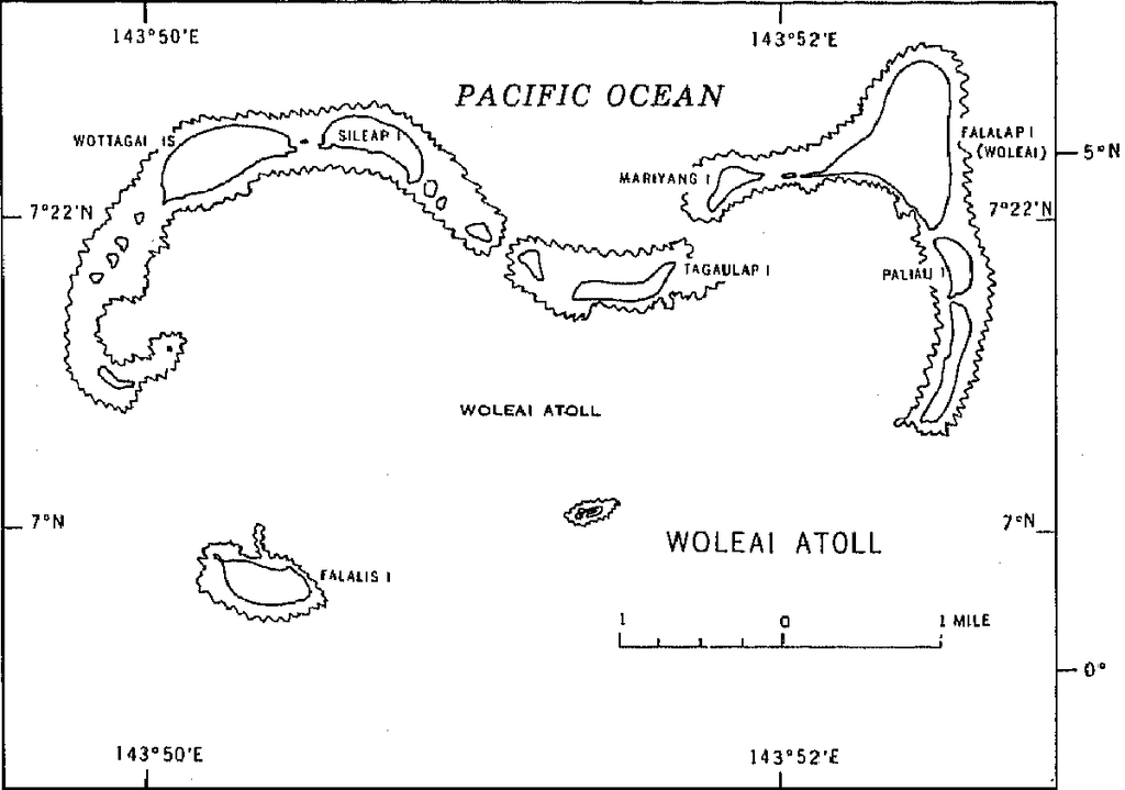
English: 1970 census of the (former) Trust Territory of the Pacific Islands (now Federated States of Micronesia, Palua, and Marshall Islands)
with several maps, including a map of Woleai Atoll, eastern Yap State |
| 日脚 | |
| 来源 | http://www2.census.gov/prod2/decennial/documents/00496492v1p54-58ch5.pdf, page 8 |
| 作者 | U.S. Bureau of the Census |
授权协议
This image or file is a work of a United States Census Bureau employee, taken or made as part of that person's official duties. As a work of the U.S. federal government, the image is in the public domain.
|
 |
文件历史
揿一个日脚/辰光来望当时出现过个文件。
| 日脚 / 辰光 | 微缩图 | 维度 | 用户 | 备注 | |
|---|---|---|---|---|---|
| 当前 | 2010年1月11号 (一) 00:50 | | 1,200 × 843(22 KB) | Ratzer | {{Information |Description={{en|1=1970 census of the (former) Trust Territory of the Pacific Islands (now Federated States of Micronesia, Palua, and Marshall Islands) with several maps, including a map of Woleai Atoll, eastern Yap State}} |Source=http://w |
文件用法
下向许1张用着箇文件:
全域文件用场
下底个其他wiki使用箇只文件: