File:Earth Western Hemisphere.jpg
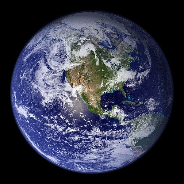
本预览个尺寸:600×600像素。 其他分辨率:240×240像素 | 480×480像素 | 768×768像素 | 1,024×1,024像素 | 2,048×2,048像素。
原始文件 (2,048×2,048像素,文件大小:579 KB,MIME类型:image/jpeg)
文件历史
揿一个日脚/辰光来望当时出现过个文件。
| 日脚 / 辰光 | 微缩图 | 维度 | 用户 | 备注 | |
|---|---|---|---|---|---|
| 当前 | 2005年8月25号 (四) 11:09 |  | 2,048 × 2,048(579 KB) | Tom | {{PD-USGov-NASA}} http://earthobservatory.nasa.gov/Newsroom/BlueMarble/Images/globe_west_2048.jpg Much of the information contained in this image came from a single remote-sensing device-NASA’s Moderate Resolution Imaging Spectroradiometer, or MODIS. |
文件用法
呒一页用着箇文件。
全域文件用场
下底个其他wiki使用箇只文件:
- af.wikipedia.org上个用途
- ang.wikipedia.org上个用途
- ar.wikipedia.org上个用途
- العالم
- الأرض
- آسيا
- قارة
- المحيط الهندي
- المحيط الهادئ
- القارة القطبية الجنوبية
- أمريكا الشمالية
- أمريكا الجنوبية
- علم البيئة
- نظام بيئي
- المحيط المتجمد الشمالي
- علوم الأرض
- المحيط المتجمد الجنوبي
- الصفائح التكتونية
- طبيعة
- محيط (جغرافيا)
- تاريخ الأرض
- حيوم
- أستراليا (قارة)
- تغير أسماء دول آسيا خلال القرن العشرين
- برية
- إفريقيا
- المحيط الأطلسي
- بوابة:المجموعة الشمسية
- تاريخ الأرض الجيولوجي
- العالم من دوننا (كتاب)
- بنية الأرض
- قالب:الأرض الطبيعية
- مستقبل الأرض
- اختلال بيئي
- أرض صلبة
- مركز مراقبة علوم وموارد الأرض
- بوابة:المجموعة الشمسية/قوالب
- تاريخ آسيا الوسطى
- بيئة طبيعية
- مستخدم:Nehaoua/مهامي
- دائرة قطبية
- تضاريس قارة إفريقيا
- الفريق المعني برصد الأرض
- بوابة:محيطات
- بوابة:محيطات/قوالب
- arz.wikipedia.org上个用途
- ast.wikipedia.org上个用途
- bg.wikipedia.org上个用途
查看本文件个更多全域用途。


