
File:Odisha locator map.svg

此SVG文件的PNG预览的大小:607×600像素。 其他分辨率:243×240像素 | 486×480像素 | 778×768像素 | 1,037×1,024像素 | 2,074×2,048像素 | 2,269×2,241像素。
原始文件 (SVG文件,名义大小:2,269×2,241像素,文件大小:211 KB)
| 标题 |
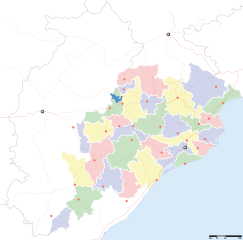
Orissa locator map |
||
| 描写 |
Locator map for the Indian state of w:Orissa. Equirectangular projection - Geographic limits of the map: top=24.27, bottom=17.691 |
||
| 日脚 | |||
| 来源 |
自家个作品 |
||
| 创作作者 |
|
||
| 许可协议 (重用本文件) |
我,本作品著作权人,特此采用以下许可协议发表本作品: 本文件用知识共享“署名-相同方式共享 3.0 未本地化版本”许可协议授权。
|
||
| Geotemporal data | |||
| 描绘日期 | 20世纪下半期和21世纪 | ||
| 地理参考 | 如果不适当,请设置 warp_status = skip 为隐藏。 | ||
| Archival data | |||
| 备注 | Part of WikiProject India Maps | ||
文件历史
揿一个日脚/辰光来望当时出现过个文件。
| 日脚 / 辰光 | 微缩图 | 维度 | 用户 | 备注 | |
|---|---|---|---|---|---|
| 当前 | 2008年9月7号 (日) 01:28 | | 2,269 × 2,241(211 KB) | Planemad | |
| 2008年2月21号 (四) 21:28 |  | 647 × 564(132 KB) | Mkeranat~commonswiki | {{Information |Description=Locator map for the state of [w:Orissa] updated to show white borders for districts |Source=self-made, based on India locator map by [w:User:Planemad] |Date=Feb 2008 |Author= Mkeranat |Permission= |other_versions= }} | |
| 2008年2月15号 (五) 05:32 |  | 647 × 564(130 KB) | Mkeranat~commonswiki | {{Information |Description=Locator map for the state of [w:Orissa] |Source=self-made, based on India locator map by [w:User:Planemad] |Date=Feb 2008 |Author= Mkeranat |Permission= |other_versions= }} |
文件用法
下向许1张用着箇文件:
全域文件用场
下底个其他wiki使用箇只文件:
- ar.wikipedia.org上个用途
- as.wikipedia.org上个用途
- awa.wikipedia.org上个用途
- ba.wikipedia.org上个用途
- ceb.wikipedia.org上个用途
- de.wikipedia.org上个用途
- en.wikipedia.org上个用途
- es.wikipedia.org上个用途
- fa.wikipedia.org上个用途
- gu.wikipedia.org上个用途
- hi.wikipedia.org上个用途
- नलबण पक्षी अभयारण्य
- साँचा:ओड़िशा के लोकसभा निर्वाचन क्षेत्र
- आस्का लोक सभा निर्वाचन क्षेत्र
- भुवनेश्वर लोक सभा निर्वाचन क्षेत्र
- बलांगिर लोक सभा निर्वाचन क्षेत्र
- कटक लोक सभा निर्वाचन क्षेत्र
- ढेंकानाल लोक सभा निर्वाचन क्षेत्र
- जगतसिंहपुर लोक सभा निर्वाचन क्षेत्र
- जाजपुर लोक सभा निर्वाचन क्षेत्र
- कलाहांडी लोक सभा निर्वाचन क्षेत्र
- कंधमाल लोक सभा निर्वाचन क्षेत्र
查看本文件个更多全域用途。